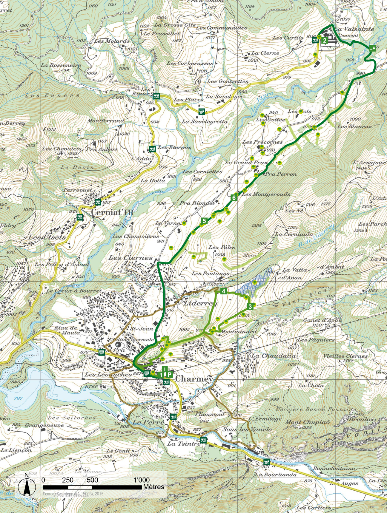
Agriculture Trail charmey - La Valsainte 

Suggestions

Itinerary

Agriculture landscape

Discover the evolution of the landscapes of the Pre-Alps shaped by agricultural activity. As you hike along, the signs and trail diary will tell you more about the ecological network of the Jogne, hedges and their uses, wet meadows and the heritage of trees.

Alternative: Montminard route

There is a second signposted variant of the farm path (light green route):

  • Distance: 3.5 km
  • Walking time: 1:15
  • Difference in altitude: 150 m

From the Charmey museum to the Montminard mountain pasture, a fairly steep section. Along the Liderrey marsh, two wooden crossings make it easier to cross drainage ditches. Two educational panels (with QR code for translation into German and English). Be sure to wear good footwear, as the section is regularly damp and not very well marked in the terrain.

Carte itinéraires de sentier agricole de la Valsainte

agriculture et paysage

en connaître davantage

Points of interest

Charmey - La Valsainte Landscape Stop
This hiking trail showcases the important contribution of farming to this pre-Alpine landscape. The agriculture trail has two signposted routes to choose from. The first leaves from Charmey museum, the second from the Charterhouse of La Valsainte.
Office du tourisme de Charmey Christophe Valley En Charrière 1
1637 Charmey
office.tourisme@charmey.ch
Hamlet of Les Ciernes (Charmey)
Agricultural landscape of the Javro valley
Charterhouse of La Valsainte